TopoTool: Topographic Mapper
TopoTool: Topographic Mapper
The official app & game
Distributed by UptoPlay
SCREENSHOTS
DESCRIPTION
Use UptoPlay to play online the game TopoTool: Topographic Mapper.
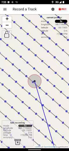
This application allows you to survey land-surfaces with your android device. This data will be converted into a digital raster model which is useful for land analysis/simulation/design. Those raster models can be exported and for example, used in QGIS
supported inputs:
- internal GPS
- Bluetooth GNSS (RTK) receiver (NMEA)
- USB-Serial GNSS (RTK) receiver (NMEA)
- CSV files (EPSG:4326) with latitude, longitude, and elevation
- GPX file
supported outputs:
- GPX file
- Ascii Grid (EPSG:3857, EPSG:4326, UTM)
- Image (.png) and world file (.pgw)
Enjoy with UptoPlay the online game TopoTool: Topographic Mapper.
ADDITIONAL INFORMATION
Developer: 2metric
Recent changes: v0.0.96 major house keeping
v0.0.95 fixed performance & DE lang
v0.0.94 added RU lang & improved authentication
v0.0.93 fixed gnss pipe
v0.0.92 fixed splash
v0.0.91 module bump
v0.0.90 gradle & java version bump
v0.0.89 fixed startup without internet
v0.0.88 improved error handling
v0.0.87 improved language change
v0.0.86 offline feedback fix
v0.0.85 improved update checker & auth
v0.0.84 fixed NaN checking
v0.0.83 fixed file-share android 11
Page navigation:

