GPS Map Camera - Geo Camera
GPS Map Camera
The official app & game
Distributed by UptoPlay
SCREENSHOTS
DESCRIPTION
Use UptoPlay to play online the game GPS Map Camera - Geo Camera.
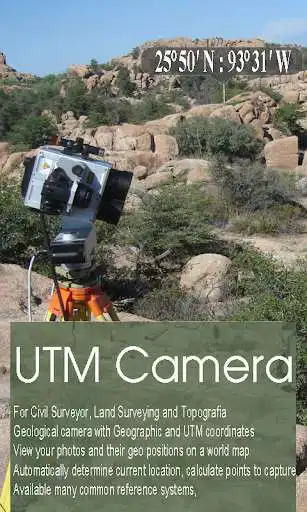
Taking photograph a waypoint/object then add UTM coordinates or geographical location. (Support collecting data for Civil Surveyor, LAND SURVEYOR, Civil Engineer, Environmental Engineer, Transportation/Traffic Engineer, GIS Engineer)
The typical functions of UTM Camera:
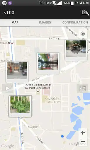
UTM Map Camera - Geo Camera: View your photos and their geo positions on a world map
UTM Map Camera - Geo Camera: Manage images with information: location, address, orientation, compass, magnetic fields,...
UTM Map Camera - Geo Camera: Automatically determine current position then calculate the coordinates of object on picture.
UTM Map Camera - Geo Camera: Support many common coordinates systems
UTM Map Camera - Geo Camera: you can add your private coordinates systems
Premium version: No ads, unlimited projects
Enjoy with UptoPlay the online game GPS Map Camera - Geo Camera.
ADDITIONAL INFORMATION
Developer: ThSoft Co.,Ltd
Genre: Tools
App version: 1.0
App size: 4.9M
Recent changes: Fix bug in gridview. User can edit, delete image in project
Comments:
You can't share or export files with location coordinates in it even in premium version. This was a waste of my time and money.
It's easily functionable and good in accuracy
Need map in it running map
very easy to use
It doesn't work"
Page navigation:

